


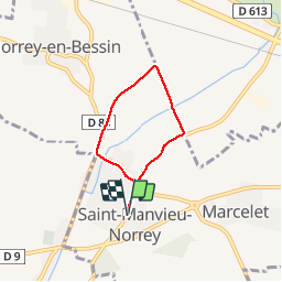
Saint Menvieu Norey

Jeff_314
User

Length
4.3 km

Max alt
79 m

Uphill gradient
32 m
Km-Effort
4.7 km

Min alt
56 m

Downhill gradient
32 m
Boucle
Yes
Creation date :
2014-12-10 00:00:00.0
Updated on :
2014-12-10 00:00:00.0
1h05
Difficulty : Easy

FREE GPS app for hiking
 SityTrail
IGN / Geographical institutes
SityTrail Plus
The world is yours!
About
Trail Walking of 4.3 km to be discovered at Normandy, Calvados, Saint-Manvieu-Norrey. This trail is proposed by Jeff_314.
Description
courte car il pleut !
Positioning
Country:
France
Region :
Normandy
Department/Province :
Calvados
Municipality :
Saint-Manvieu-Norrey
Location:
Unknown
Start:(Dec)
Start:(UTM)
682056 ; 5450523 (30U) N.
Comments