


Paley

jynenault
User

Length
17.4 km

Max alt
132 m

Uphill gradient
149 m
Km-Effort
19.4 km

Min alt
85 m

Downhill gradient
150 m
Boucle
Yes
Creation date :
2014-12-10 00:00:00.0
Updated on :
2014-12-10 00:00:00.0
4h22
Difficulty : Easy

FREE GPS app for hiking
 SityTrail
IGN / Geographical institutes
SityTrail Plus
The world is yours!
About
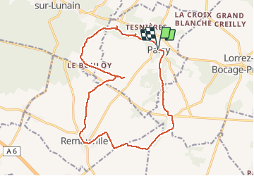
Trail Walking of 17.4 km to be discovered at Ile-de-France, Seine-et-Marne, Paley. This trail is proposed by jynenault.
Description
simple
Positioning
Country:
France
Region :
Ile-de-France
Department/Province :
Seine-et-Marne
Municipality :
Paley
Location:
Unknown
Start:(Dec)
Start:(UTM)
489647 ; 5343210 (31U) N.
Comments