


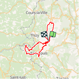
Autour du lac des sapins

ramsay
User

Length
48 km

Max alt
759 m

Uphill gradient
1253 m
Km-Effort
65 km

Min alt
380 m

Downhill gradient
1251 m
Boucle
Yes
Creation date :
2014-12-10 00:00:00.0
Updated on :
2014-12-10 00:00:00.0
4h06
Difficulty : Difficult

FREE GPS app for hiking
 SityTrail
IGN / Geographical institutes
SityTrail Plus
The world is yours!
About
Trail Mountain bike of 48 km to be discovered at Auvergne-Rhône-Alpes, Rhône, Cublize. This trail is proposed by ramsay.
Description
Randonnée VTT de 48 km
Positioning
Country:
France
Region :
Auvergne-Rhône-Alpes
Department/Province :
Rhône
Municipality :
Cublize
Location:
Unknown
Start:(Dec)
Start:(UTM)
606499 ; 5096146 (31T) N.
Comments