


L'Ancêtre de Perthe_8,2 km_Trace GPS

Pousscailleux
User
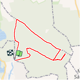

Length
8.2 km

Max alt
133 m

Uphill gradient
104 m
Km-Effort
9.6 km

Min alt
70 m

Downhill gradient
102 m
Boucle
Yes
Creation date :
2014-12-10 00:00:00.0
Updated on :
2014-12-10 00:00:00.0
2h07
Difficulty : Very easy

FREE GPS app for hiking
 SityTrail
IGN / Geographical institutes
SityTrail Plus
The world is yours!
About
Trail Walking of 8.2 km to be discovered at Hauts-de-France, Oise, Fontaine-Chaalis. This trail is proposed by Pousscailleux.
Positioning
Country:
France
Region :
Hauts-de-France
Department/Province :
Oise
Municipality :
Fontaine-Chaalis
Location:
Unknown
Start:(Dec)
Start:(UTM)
477890 ; 5442534 (31U) N.
Comments