


le tour de Frustel

jynenault
User

Length
8.3 km

Max alt
1411 m

Uphill gradient
305 m
Km-Effort
12.4 km

Min alt
1120 m

Downhill gradient
306 m
Boucle
Yes
Creation date :
2014-12-10 00:00:00.0
Updated on :
2014-12-10 00:00:00.0
2h46
Difficulty : Medium

FREE GPS app for hiking
 SityTrail
IGN / Geographical institutes
SityTrail Plus
The world is yours!
About
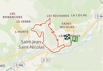
Trail Walking of 8.3 km to be discovered at Provence-Alpes-Côte d'Azur, Hautes-Alpes, Saint-Jean-Saint-Nicolas. This trail is proposed by jynenault.
Description
grimpe
Positioning
Country:
France
Region :
Provence-Alpes-Côte d'Azur
Department/Province :
Hautes-Alpes
Municipality :
Saint-Jean-Saint-Nicolas
Location:
Unknown
Start:(Dec)
Start:(UTM)
281265 ; 4949941 (32T) N.
Comments