


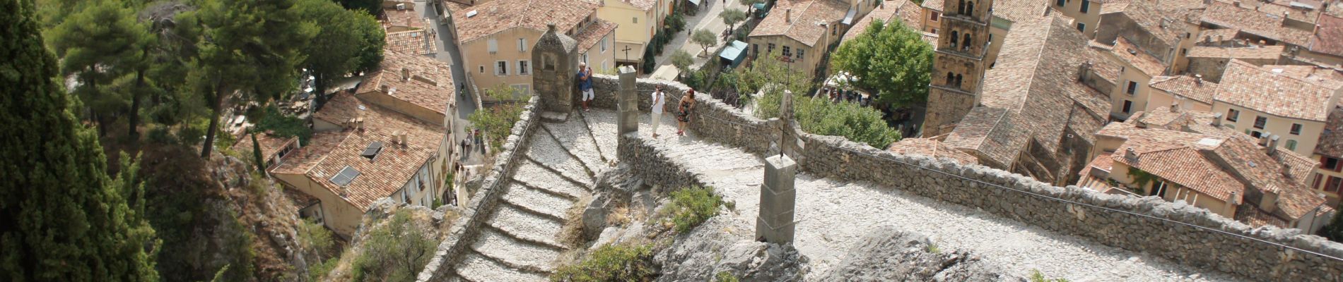
Moutiers Sainte Marie - Voie Romaine vers Vénascle

Alfredy
User GUIDE
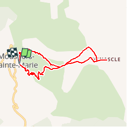

Length
7.7 km

Max alt
976 m

Uphill gradient
364 m
Km-Effort
12.5 km

Min alt
663 m

Downhill gradient
366 m
Boucle
Yes
Creation date :
2018-05-17 13:04:19.463
Updated on :
2018-05-18 11:54:14.231
2h40
Difficulty : Medium

FREE GPS app for hiking
 SityTrail
IGN / Geographical institutes
SityTrail Plus
The world is yours!
About
Trail Walking of 7.7 km to be discovered at Provence-Alpes-Côte d'Azur, Alpes-de-Haute-Provence, Moustiers-Sainte-Marie. This trail is proposed by Alfredy.
Description
Randonnée créée via l'éditeur de SityTrail à tester sur le terrain....
Soyez donc prudent.
Photos


Positioning
Country:
France
Region :
Provence-Alpes-Côte d'Azur
Department/Province :
Alpes-de-Haute-Provence
Municipality :
Moustiers-Sainte-Marie
Location:
Unknown
Start:(Dec)
Start:(UTM)
276769 ; 4858411 (32T) N.
Comments