


Ejsos

ilur56
User
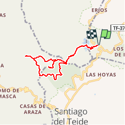

Length
9.8 km

Max alt
1325 m

Uphill gradient
469 m
Km-Effort
16 km

Min alt
1023 m

Downhill gradient
469 m
Boucle
Yes
Creation date :
2018-07-02 10:46:10.798
Updated on :
2018-08-15 18:40:17.799
4h09
Difficulty : Medium

FREE GPS app for hiking
 SityTrail
IGN / Geographical institutes
SityTrail Plus
The world is yours!
About
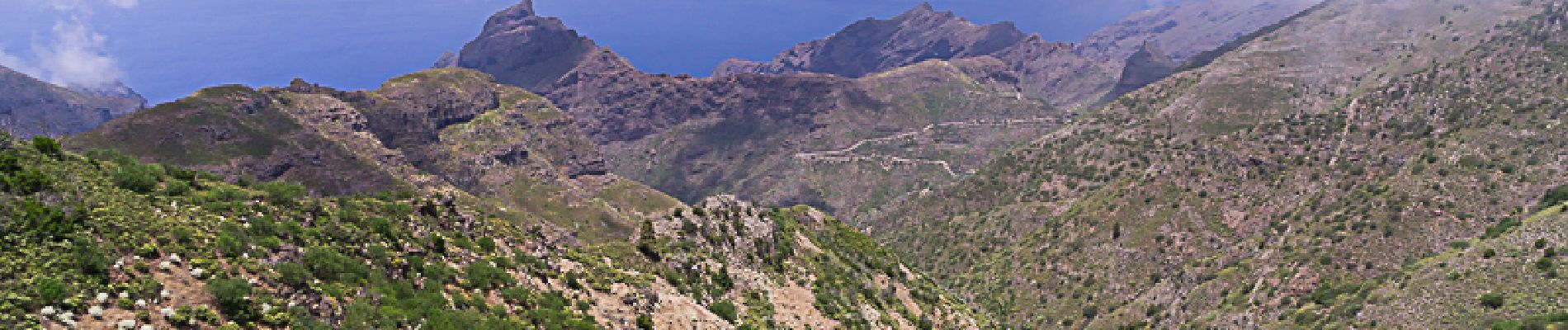
Trail Walking of 9.8 km to be discovered at Canary Islands, Santa Cruz de Tenerife, El Tanque. This trail is proposed by ilur56.
Photos


Positioning
Country:
Spain
Region :
Canary Islands
Department/Province :
Santa Cruz de Tenerife
Municipality :
El Tanque
Location:
Unknown
Start:(Dec)
Start:(UTM)
323077 ; 3133735 (28R) N.
Comments