


20170921-Grieu

doudet
User
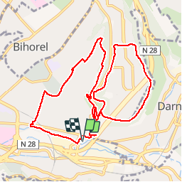

Length
11.2 km

Max alt
144 m

Uphill gradient
267 m
Km-Effort
14.8 km

Min alt
12 m

Downhill gradient
267 m
Boucle
Yes
Creation date :
2018-08-13 06:29:16.577
Updated on :
2018-08-13 06:29:16.577

FREE GPS app for hiking
 SityTrail
IGN / Geographical institutes
SityTrail Plus
The world is yours!
About
Trail of 11.2 km to be discovered at Normandy, Seine-Maritime, Rouen. This trail is proposed by doudet.
Positioning
Country:
France
Region :
Normandy
Department/Province :
Seine-Maritime
Municipality :
Rouen
Location:
Unknown
Start:(Dec)
Start:(UTM)
364333 ; 5477973 (31U) N.
Comments