


20180528130420-h74dj

c.chehere
User
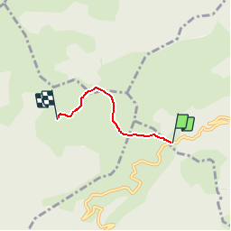

Length
2.7 km

Max alt
1811 m

Uphill gradient
158 m
Km-Effort
4.4 km

Min alt
1676 m

Downhill gradient
33 m
Boucle
No
Creation date :
2018-08-30 09:42:34.689
Updated on :
2018-09-23 10:12:05.316
58m
Difficulty : Easy

FREE GPS app for hiking
 SityTrail
IGN / Geographical institutes
SityTrail Plus
The world is yours!
About
Trail Walking of 2.7 km to be discovered at Occitania, Aude, La Fajolle. This trail is proposed by c.chehere.
Description
Parking au col de Pradel
Positioning
Country:
France
Region :
Occitania
Department/Province :
Aude
Municipality :
La Fajolle
Location:
Unknown
Start:(Dec)
Start:(UTM)
413191 ; 4733344 (31T) N.
Comments