


2018-09-05_15h29m41_Lac Sans Fond et col de Forclaz

PhilippeC54
User
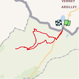

Length
14.3 km

Max alt
2525 m

Uphill gradient
604 m
Km-Effort
22 km

Min alt
2120 m

Downhill gradient
603 m
Boucle
Yes
Creation date :
2018-09-10 10:06:01.808
Updated on :
2018-09-10 10:10:17.024
4h37
Difficulty : Very difficult

FREE GPS app for hiking
 SityTrail
IGN / Geographical institutes
SityTrail Plus
The world is yours!
About
Trail Walking of 14.3 km to be discovered at Auvergne-Rhône-Alpes, Savoy, Séez. This trail is proposed by PhilippeC54.
Positioning
Country:
France
Region :
Auvergne-Rhône-Alpes
Department/Province :
Savoy
Municipality :
Séez
Location:
Unknown
Start:(Dec)
Start:(UTM)
335141 ; 5060601 (32T) N.
Comments