


balade le pal croix de moliere

raab
User
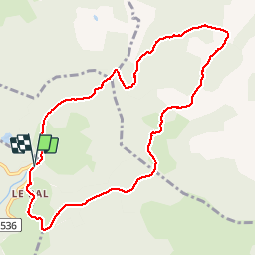

Length
9.8 km

Max alt
1319 m

Uphill gradient
218 m
Km-Effort
12.7 km

Min alt
1192 m

Downhill gradient
220 m
Boucle
Yes
Creation date :
2018-09-10 12:07:49.692
Updated on :
2018-09-10 15:05:53.58
2h56
Difficulty : Very easy

FREE GPS app for hiking
 SityTrail
IGN / Geographical institutes
SityTrail Plus
The world is yours!
About
Trail Walking of 9.8 km to be discovered at Auvergne-Rhône-Alpes, Ardèche, Le Roux. This trail is proposed by raab.
Positioning
Country:
France
Region :
Auvergne-Rhône-Alpes
Department/Province :
Ardèche
Municipality :
Le Roux
Location:
Unknown
Start:(Dec)
Start:(UTM)
592547 ; 4954675 (31T) N.
Comments