


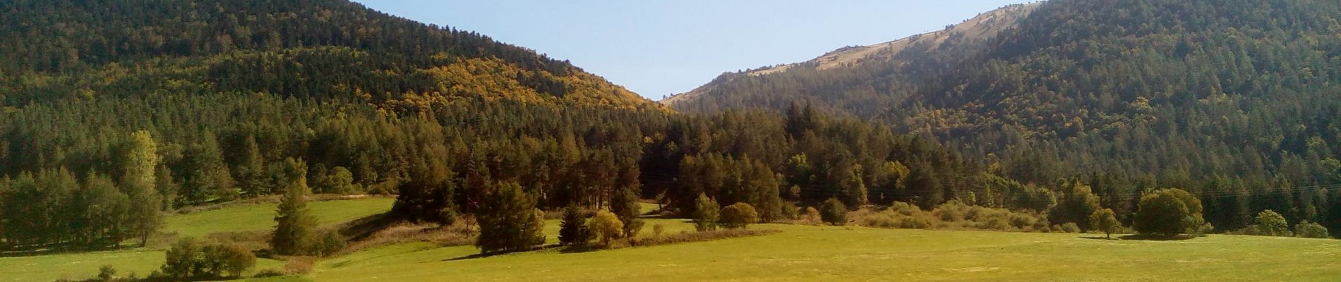
les crêtes de Camurac

c.chehere
User


4h30
Difficulty : Medium

FREE GPS app for hiking
 SityTrail
IGN / Geographical institutes
SityTrail Plus
The world is yours!
About
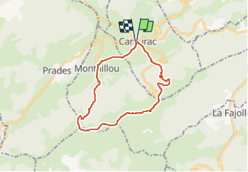
Trail Walking of 15.6 km to be discovered at Occitania, Aude, Camurac. This trail is proposed by c.chehere.
Description
Itinéraire balisé en jaune et GR.
Parking à coté du monument aux morts de Camurac (tables et toilettes)
Partir par la route D1020 en direction de la station de ski.
Suivre le balisage et monter jusqu'au col de Teil
Suivre le sentier en crête jusqu'au col de Balaguès.
Vues splendides sur les Pyrénées Ariégieoises.
Au col redescendre par un sentier assez raide au départ jusqu'à Montaillou.
Suivre la piste pour arriver à Camurac
Photos


Positioning
Comments