


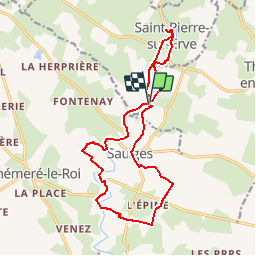
8981267-saulges thévalle

eric.deniau
User

Length
15.8 km

Max alt
104 m

Uphill gradient
237 m
Km-Effort
19 km

Min alt
52 m

Downhill gradient
248 m
Boucle
Yes
Creation date :
2018-10-06 14:25:35.92
Updated on :
2018-10-08 20:23:23.974
4h08
Difficulty : Difficult

FREE GPS app for hiking
 SityTrail
IGN / Geographical institutes
SityTrail Plus
The world is yours!
About
Trail Walking of 15.8 km to be discovered at Pays de la Loire, Mayenne, Thorigné-en-Charnie. This trail is proposed by eric.deniau.
Positioning
Country:
France
Region :
Pays de la Loire
Department/Province :
Mayenne
Municipality :
Thorigné-en-Charnie
Location:
Unknown
Start:(Dec)
Start:(UTM)
693946 ; 5318874 (30T) N.
Comments