


Vilcey-sur-Trey

PhilippeC54
User
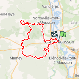

Length
33 km

Max alt
383 m

Uphill gradient
604 m
Km-Effort
41 km

Min alt
177 m

Downhill gradient
602 m
Boucle
Yes
Creation date :
2018-10-07 06:32:26.141
Updated on :
2019-03-19 18:11:08.483
2h43
Difficulty : Difficult

FREE GPS app for hiking
 SityTrail
IGN / Geographical institutes
SityTrail Plus
The world is yours!
About
Trail Mountain bike of 33 km to be discovered at Grand Est, Meurthe-et-Moselle, Pont-à-Mousson. This trail is proposed by PhilippeC54.
Positioning
Country:
France
Region :
Grand Est
Department/Province :
Meurthe-et-Moselle
Municipality :
Pont-à-Mousson
Location:
Unknown
Start:(Dec)
Start:(UTM)
284247 ; 5420944 (32U) N.
Comments