


Tour du Boum

c.chehere
User
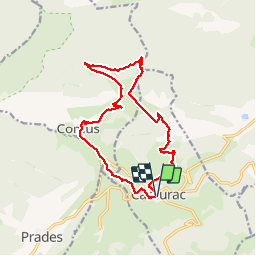

Length
16.8 km

Max alt
1395 m

Uphill gradient
458 m
Km-Effort
23 km

Min alt
1167 m

Downhill gradient
461 m
Boucle
Yes
Creation date :
2018-10-08 06:15:47.35
Updated on :
2018-10-08 12:31:25.215
4h00
Difficulty : Easy

FREE GPS app for hiking
 SityTrail
IGN / Geographical institutes
SityTrail Plus
The world is yours!
About
Trail Walking of 16.8 km to be discovered at Occitania, Aude, Camurac. This trail is proposed by c.chehere.
Description
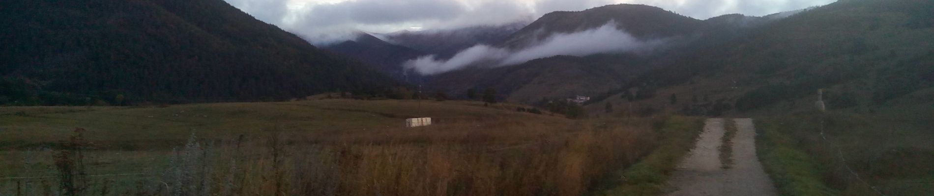
Belle rando dans des belles forets sur des sentiers sans difficultés.
Seul le refuge au col de Lancise est ouvert. pas de couchage.
Balisé jaune et Blanc/rouge
Photos


Positioning
Country:
France
Region :
Occitania
Department/Province :
Aude
Municipality :
Camurac
Location:
Unknown
Start:(Dec)
Start:(UTM)
411457 ; 4738789 (31T) N.
Comments