


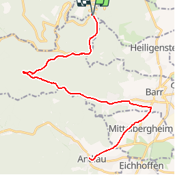
P15_Andlau_26-615

PhilippeC54
User

Length
26 km

Max alt
665 m

Uphill gradient
660 m
Km-Effort
35 km

Min alt
224 m

Downhill gradient
660 m
Boucle
Yes
Creation date :
2018-10-16 21:24:50.576
Updated on :
2018-10-16 21:28:59.308
2h14
Difficulty : Difficult

FREE GPS app for hiking
 SityTrail
IGN / Geographical institutes
SityTrail Plus
The world is yours!
About
Trail Mountain bike of 26 km to be discovered at Grand Est, Bas-Rhin, Obernai. This trail is proposed by PhilippeC54.
Positioning
Country:
France
Region :
Grand Est
Department/Province :
Bas-Rhin
Municipality :
Obernai
Location:
Unknown
Start:(Dec)
Start:(UTM)
383012 ; 5365823 (32U) N.
Comments