


Madine 2019

PhilippeC54
User

Length
37 km

Max alt
404 m

Uphill gradient
481 m
Km-Effort
43 km

Min alt
214 m

Downhill gradient
484 m
Boucle
Yes
Creation date :
2019-01-13 08:27:37.468
Updated on :
2019-11-15 09:47:24.562
3h09
Difficulty : Very easy

FREE GPS app for hiking
 SityTrail
IGN / Geographical institutes
SityTrail Plus
The world is yours!
About
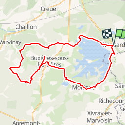
Trail Mountain bike of 37 km to be discovered at Grand Est, Meuse, Nonsard-Lamarche. This trail is proposed by PhilippeC54.
Description
Chapelle des Bures inaccessible à cause de la chasse.
Collatrion au lavoir de Buxieres
Positioning
Country:
France
Region :
Grand Est
Department/Province :
Meuse
Municipality :
Nonsard-Lamarche
Location:
Unknown
Start:(Dec)
Start:(UTM)
702367 ; 5423481 (31U) N.
Comments