


Plan B pour Au sud des trois pignons

c.chehere
User
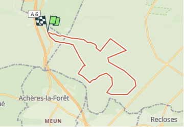

Length
15.6 km

Max alt
142 m

Uphill gradient
134 m
Km-Effort
17.4 km

Min alt
81 m

Downhill gradient
133 m
Boucle
Yes
Creation date :
2019-01-19 16:54:42.887
Updated on :
2019-01-19 16:57:32.787
3h51
Difficulty : Easy

FREE GPS app for hiking
 SityTrail
IGN / Geographical institutes
SityTrail Plus
The world is yours!
About
Trail Walking of 15.6 km to be discovered at Ile-de-France, Seine-et-Marne, Noisy-sur-École. This trail is proposed by c.chehere.
Description
En remplacement de la rando "au sud des trois pignons"
Positioning
Country:
France
Region :
Ile-de-France
Department/Province :
Seine-et-Marne
Municipality :
Noisy-sur-École
Location:
Unknown
Start:(Dec)
Start:(UTM)
467668 ; 5359415 (31U) N.
Comments