


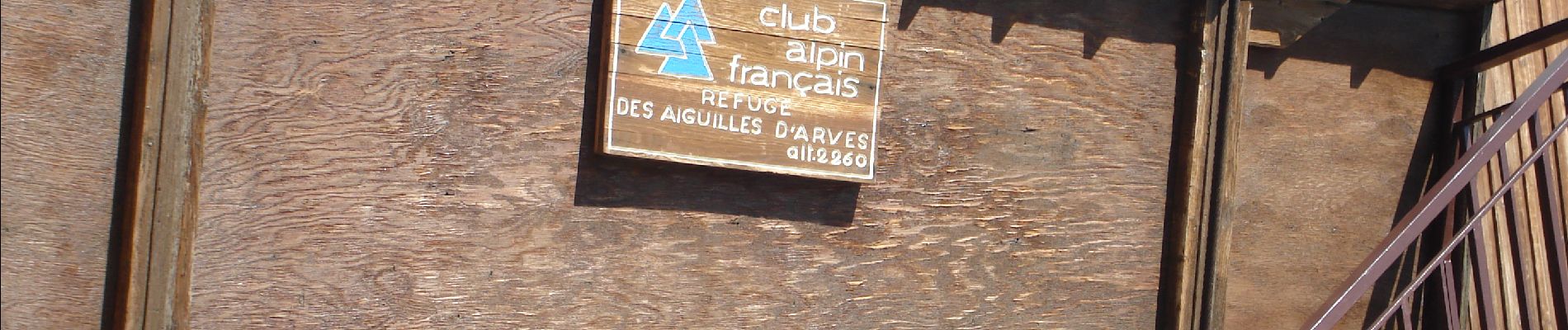
Les Aiguilles D'Arves en partant des Verneys VALLOIRE

verotrail
User
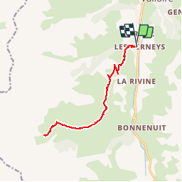

Length
15.8 km

Max alt
2243 m

Uphill gradient
853 m
Km-Effort
27 km

Min alt
1567 m

Downhill gradient
857 m
Boucle
Yes
Creation date :
2019-02-03 13:48:28.798
Updated on :
2019-02-03 13:55:22.782
--
Difficulty : Difficult

FREE GPS app for hiking
 SityTrail
IGN / Geographical institutes
SityTrail Plus
The world is yours!
About
Trail On foot of 15.8 km to be discovered at Auvergne-Rhône-Alpes, Savoy, Valloire. This trail is proposed by verotrail.
Photos


Positioning
Country:
France
Region :
Auvergne-Rhône-Alpes
Department/Province :
Savoy
Municipality :
Valloire
Location:
Unknown
Start:(Dec)
Start:(UTM)
297090 ; 5002656 (32T) N.
Comments