


Reillon (Les Entonnoirs)

MMarie
User
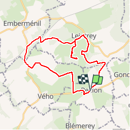

Length
17.6 km

Max alt
304 m

Uphill gradient
222 m
Km-Effort
21 km

Min alt
244 m

Downhill gradient
220 m
Boucle
Yes
Creation date :
2014-12-10 00:00:00.0
Updated on :
2014-12-10 00:00:00.0
4h27
Difficulty : Medium

FREE GPS app for hiking
 SityTrail
IGN / Geographical institutes
SityTrail Plus
The world is yours!
About
Trail Walking of 17.6 km to be discovered at Grand Est, Meurthe-et-Moselle, Reillon. This trail is proposed by MMarie.
Description
Topo-Guide N°9
La Lorraine à pied
7 Juillet 2013
Sentiers non entretenus
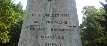
Photos
 - Photo 1")
 - Photo 2")
 - Photo 3")
 - Photo 4")
 - Photo 5")
 - Photo 6")
 - Photo 7")
 - Photo 8")
 - Photo 9")


Positioning
Country:
France
Region :
Grand Est
Department/Province :
Meurthe-et-Moselle
Municipality :
Reillon
Location:
Unknown
Start:(Dec)
Start:(UTM)
333618 ; 5385299 (32U) N.
Comments