


riboux les enfers

Coryphene
User
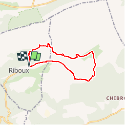

Length
12.4 km

Max alt
624 m

Uphill gradient
231 m
Km-Effort
15.5 km

Min alt
523 m

Downhill gradient
232 m
Boucle
Yes
Creation date :
2019-02-21 10:16:21.948
Updated on :
2019-09-24 15:14:48.195
5h24
Difficulty : Very easy

FREE GPS app for hiking
 SityTrail
IGN / Geographical institutes
SityTrail Plus
The world is yours!
About
Trail Walking of 12.4 km to be discovered at Provence-Alpes-Côte d'Azur, Var, Riboux. This trail is proposed by Coryphene.
Positioning
Country:
France
Region :
Provence-Alpes-Côte d'Azur
Department/Province :
Var
Municipality :
Riboux
Location:
Unknown
Start:(Dec)
Start:(UTM)
724153 ; 4798384 (31T) N.
Comments
un peut de goudron mais simpat