


La Commanderie V2

verpoorten
User
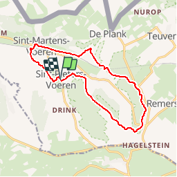

Length
12.6 km

Max alt
287 m

Uphill gradient
217 m
Km-Effort
15.4 km

Min alt
124 m

Downhill gradient
214 m
Boucle
Yes
Creation date :
2019-02-24 15:06:57.674
Updated on :
2019-02-24 15:08:36.433
3h20
Difficulty : Difficult

FREE GPS app for hiking
 SityTrail
IGN / Geographical institutes
SityTrail Plus
The world is yours!
About
Trail Walking of 12.6 km to be discovered at Flanders, Limburg, Voeren. This trail is proposed by verpoorten.
Photos

Positioning
Country:
Belgium
Region :
Flanders
Department/Province :
Limburg
Municipality :
Voeren
Location:
Sint-Pieters-Voeren
Start:(Dec)
Start:(UTM)
699212 ; 5624474 (31U) N.
Comments
Randonnée à chemins variés et boisés