


mort marre

randolea
User
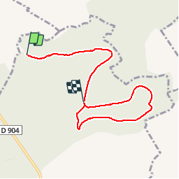

Length
6.6 km

Max alt
339 m

Uphill gradient
106 m
Km-Effort
7.9 km

Min alt
276 m

Downhill gradient
55 m
Boucle
No
Creation date :
2019-03-03 09:11:56.6
Updated on :
2019-03-03 13:57:05.231
1h34
Difficulty : Very easy

FREE GPS app for hiking
 SityTrail
IGN / Geographical institutes
SityTrail Plus
The world is yours!
About
Trail Walking of 6.6 km to be discovered at Grand Est, Meurthe-et-Moselle, Flirey. This trail is proposed by randolea.
Description
Marche
Positioning
Country:
France
Region :
Grand Est
Department/Province :
Meurthe-et-Moselle
Municipality :
Flirey
Location:
Unknown
Start:(Dec)
Start:(UTM)
708272 ; 5420709 (31U) N.
Comments