


La randonnée sandwich entre la LGV et la RN10

alainjoseph6
User
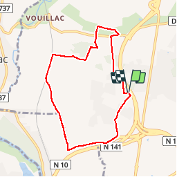

Length
7.7 km

Max alt
109 m

Uphill gradient
152 m
Km-Effort
9.7 km

Min alt
40 m

Downhill gradient
150 m
Boucle
Yes
Creation date :
2019-03-07 14:13:19.625
Updated on :
2019-03-07 17:55:50.133
2h25
Difficulty : Very easy

FREE GPS app for hiking
 SityTrail
IGN / Geographical institutes
SityTrail Plus
The world is yours!
About
Trail Walking of 7.7 km to be discovered at New Aquitaine, Charente, Champniers. This trail is proposed by alainjoseph6.
Description
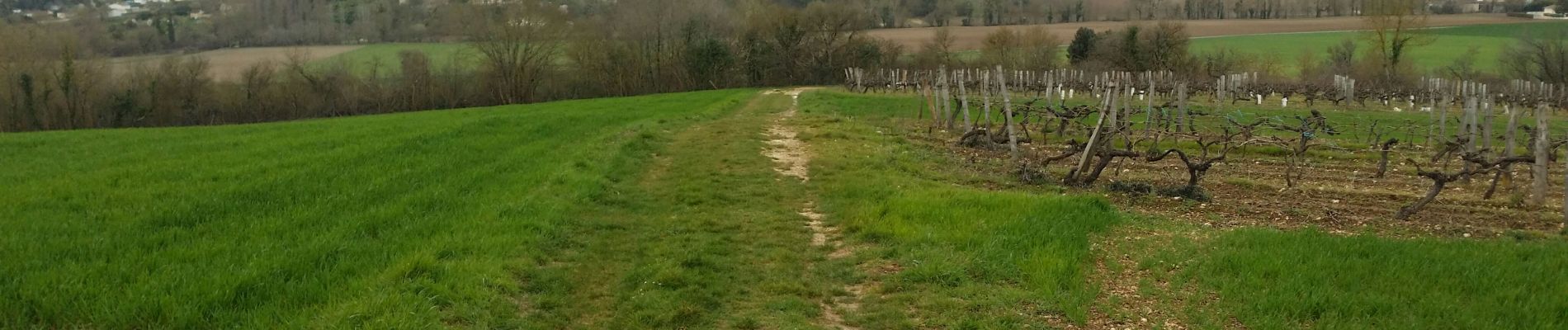
C'est une randonnée surprise, qui fait découvrir une superbe campagne aux portes D'ANGOULÊME.
A faire.
Photos


Positioning
Country:
France
Region :
New Aquitaine
Department/Province :
Charente
Municipality :
Champniers
Location:
Unknown
Start:(Dec)
Start:(UTM)
280269 ; 5064959 (31T) N.
Comments