


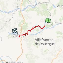
Figeac- cahors. Voie du Célé

ghislainem
User

Length
116 km

Max alt
356 m

Uphill gradient
3092 m
Km-Effort
157 km

Min alt
112 m

Downhill gradient
3165 m
Boucle
No
Creation date :
2019-03-10 17:24:41.226
Updated on :
2019-03-10 17:28:21.427
--
Difficulty : Very easy

FREE GPS app for hiking
 SityTrail
IGN / Geographical institutes
SityTrail Plus
The world is yours!
About
Trail On foot of 116 km to be discovered at Occitania, Lot, Figeac. This trail is proposed by ghislainem.
Positioning
Country:
France
Region :
Occitania
Department/Province :
Lot
Municipality :
Figeac
Location:
Unknown
Start:(Dec)
Start:(UTM)
423126 ; 4939798 (31T) N.
Comments