


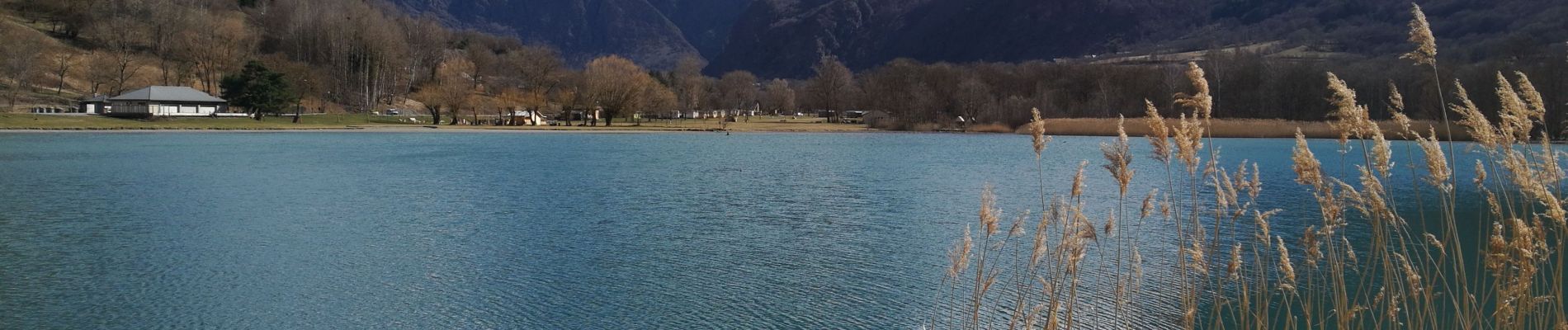
Plan d'eau de Valbonnais - Les Angelas

maupassant38
User
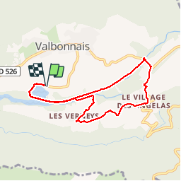

Length
8.3 km

Max alt
807 m

Uphill gradient
117 m
Km-Effort
9.8 km

Min alt
703 m

Downhill gradient
117 m
Boucle
Yes
Creation date :
2019-03-13 10:45:36.846
Updated on :
2019-03-13 17:42:06.081
1h55
Difficulty : Easy

FREE GPS app for hiking
 SityTrail
IGN / Geographical institutes
SityTrail Plus
The world is yours!
About
Trail Walking of 8.3 km to be discovered at Auvergne-Rhône-Alpes, Isère, Valbonnais. This trail is proposed by maupassant38.
Photos


Positioning
Country:
France
Region :
Auvergne-Rhône-Alpes
Department/Province :
Isère
Municipality :
Valbonnais
Location:
Unknown
Start:(Dec)
Start:(UTM)
729070 ; 4975166 (31T) N.
Comments