


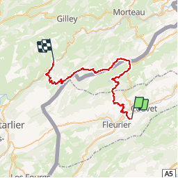
La Vy aux Moines Môtiers-La Brévine- Montbenoit

TRIMAILLE
User

Length
39 km

Max alt
1233 m

Uphill gradient
1441 m
Km-Effort
58 km

Min alt
729 m

Downhill gradient
1394 m
Boucle
No
Creation date :
2019-03-15 16:28:18.163
Updated on :
2019-03-15 19:27:49.182

FREE GPS app for hiking
 SityTrail
IGN / Geographical institutes
SityTrail Plus
The world is yours!
About
Trail of 39 km to be discovered at Neuchâtel, Unknown, Val-de-Travers. This trail is proposed by TRIMAILLE.

Positioning
Country:
Switzerland
Region :
Neuchâtel
Department/Province :
Unknown
Municipality :
Val-de-Travers
Location:
Unknown
Start:(Dec)
Start:(UTM)
317998 ; 5198138 (32T) N.
Comments