


Caussols

verotrail
User
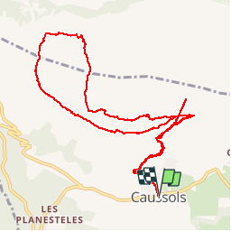

Length
13.8 km

Max alt
1452 m

Uphill gradient
484 m
Km-Effort
20 km

Min alt
1100 m

Downhill gradient
484 m
Boucle
Yes
Creation date :
2019-03-17 09:30:49.249
Updated on :
2019-03-17 20:31:17.078
5h29
Difficulty : Medium

FREE GPS app for hiking
 SityTrail
IGN / Geographical institutes
SityTrail Plus
The world is yours!
About
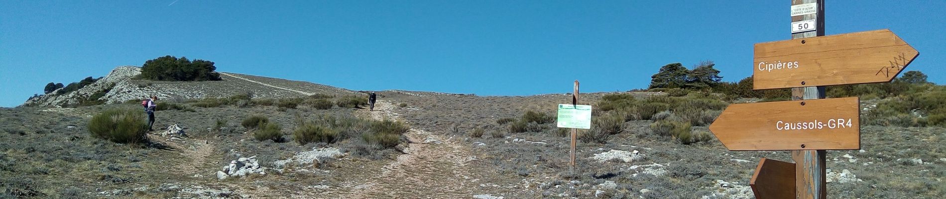
Trail Walking of 13.8 km to be discovered at Provence-Alpes-Côte d'Azur, Maritime Alps, Caussols. This trail is proposed by verotrail.
Photos


Positioning
Country:
France
Region :
Provence-Alpes-Côte d'Azur
Department/Province :
Maritime Alps
Municipality :
Caussols
Location:
Unknown
Start:(Dec)
Start:(UTM)
330902 ; 4845280 (32T) N.
Comments