


Aller Argeles-Port Vendres retour Bus.

rene06530
User

Length
13.4 km

Max alt
151 m

Uphill gradient
287 m
Km-Effort
17.2 km

Min alt
-1 m

Downhill gradient
284 m
Boucle
No
Creation date :
2019-03-20 12:00:04.461
Updated on :
2019-03-20 12:04:03.526
--
Difficulty : Medium

FREE GPS app for hiking
 SityTrail
IGN / Geographical institutes
SityTrail Plus
The world is yours!
About
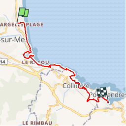
Trail On foot of 13.4 km to be discovered at Occitania, Pyrénées-Orientales, Argelès-sur-Mer. This trail is proposed by rene06530.
Description
Argeles -Port Vendres via port Argeles, le Racou, sentier littoral, plage de l'ouille, Collioure, fort St Elme, port Vendres.
Positioning
Country:
France
Region :
Occitania
Department/Province :
Pyrénées-Orientales
Municipality :
Argelès-sur-Mer
Location:
Unknown
Start:(Dec)
Start:(UTM)
503443 ; 4711620 (31T) N.
Comments