


is 20130714

alexbnmr
User
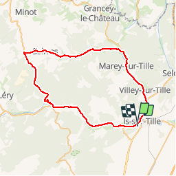

Length
57 km

Max alt
521 m

Uphill gradient
698 m
Km-Effort
66 km

Min alt
272 m

Downhill gradient
682 m
Boucle
No
Creation date :
2014-12-10 00:00:00.0
Updated on :
2014-12-10 00:00:00.0
2h27
Difficulty : Unknown

FREE GPS app for hiking
 SityTrail
IGN / Geographical institutes
SityTrail Plus
The world is yours!
About
Trail Cycle of 57 km to be discovered at Bourgogne-Franche-Comté, Côte-d'Or, Is-sur-Tille. This trail is proposed by alexbnmr.
Positioning
Country:
France
Region :
Bourgogne-Franche-Comté
Department/Province :
Côte-d'Or
Municipality :
Is-sur-Tille
Location:
Unknown
Start:(Dec)
Start:(UTM)
658269 ; 5264769 (31T) N.
Comments