


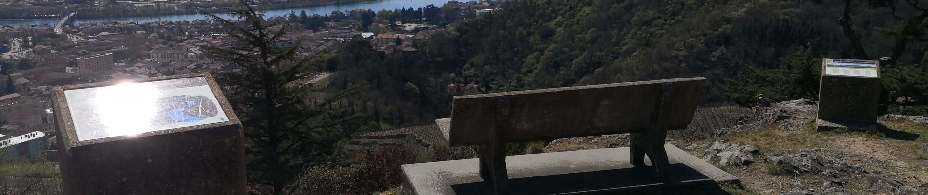
Condrieu-Les vignes

Sigmut
User
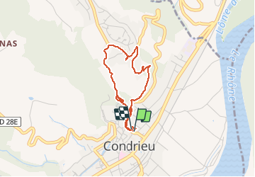

Length
3.3 km

Max alt
312 m

Uphill gradient
154 m
Km-Effort
5.3 km

Min alt
153 m

Downhill gradient
154 m
Boucle
Yes
Creation date :
2019-03-31 11:02:00.628
Updated on :
2020-12-10 22:47:44.785
1h39
Difficulty : Very easy

FREE GPS app for hiking
 SityTrail
IGN / Geographical institutes
SityTrail Plus
The world is yours!
About
Trail Walking of 3.3 km to be discovered at Auvergne-Rhône-Alpes, Rhône, Condrieu. This trail is proposed by Sigmut.
Description
Randonnée facile mais grimpante pour dégourdir les jambes des enfants
Photos

Positioning
Country:
France
Region :
Auvergne-Rhône-Alpes
Department/Province :
Rhône
Municipality :
Condrieu
Location:
Unknown
Start:(Dec)
Start:(UTM)
638239 ; 5035982 (31T) N.
Comments