


Bitche-Seebach-Niederbronn-Bitche_Route_124km_1115m

lucienp
User
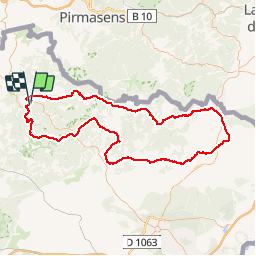

Length
124 km

Max alt
496 m

Uphill gradient
2006 m
Km-Effort
151 km

Min alt
143 m

Downhill gradient
2000 m
Boucle
Yes
Creation date :
2016-10-02 00:00:00.0
Updated on :
2016-10-02 00:00:00.0
8h11
Difficulty : Difficult

FREE GPS app for hiking
 SityTrail
IGN / Geographical institutes
SityTrail Plus
The world is yours!
About
Trail Cycle of 124 km to be discovered at Grand Est, Moselle, Bitche. This trail is proposed by lucienp.
Description
Randonnée villages alsaciens au départ de Bitche
Positioning
Country:
France
Region :
Grand Est
Department/Province :
Moselle
Municipality :
Bitche
Location:
Unknown
Start:(Dec)
Start:(UTM)
386090 ; 5433078 (32U) N.
Comments