


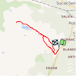
Étangs de Bassies

petit-pied
User

Length
14.8 km

Max alt
1672 m

Uphill gradient
923 m
Km-Effort
27 km

Min alt
850 m

Downhill gradient
926 m
Boucle
Yes
Creation date :
2019-04-07 08:20:30.144
Updated on :
2019-04-08 15:35:58.698
6h13
Difficulty : Medium

FREE GPS app for hiking
 SityTrail
IGN / Geographical institutes
SityTrail Plus
The world is yours!
About
Trail Walking of 14.8 km to be discovered at Occitania, Ariège, Auzat. This trail is proposed by petit-pied.
Positioning
Country:
France
Region :
Occitania
Department/Province :
Ariège
Municipality :
Auzat
Location:
Unknown
Start:(Dec)
Start:(UTM)
374143 ; 4733402 (31T) N.
Comments