


Boyeux-Lhuire-St Jérôme

micheldutilleul
User
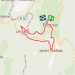

Length
5.6 km

Max alt
545 m

Uphill gradient
205 m
Km-Effort
8.3 km

Min alt
353 m

Downhill gradient
206 m
Boucle
Yes
Creation date :
2019-04-08 08:48:20.774
Updated on :
2019-04-10 12:49:07.194
1h40
Difficulty : Very easy

FREE GPS app for hiking
 SityTrail
IGN / Geographical institutes
SityTrail Plus
The world is yours!
About
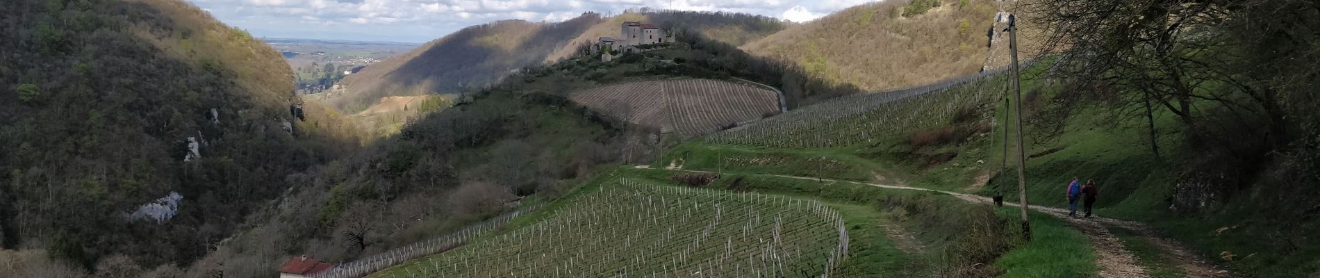
Trail Walking of 5.6 km to be discovered at Auvergne-Rhône-Alpes, Ain, Boyeux-Saint-Jérôme. This trail is proposed by micheldutilleul.
Photos

Positioning
Country:
France
Region :
Auvergne-Rhône-Alpes
Department/Province :
Ain
Municipality :
Boyeux-Saint-Jérôme
Location:
Unknown
Start:(Dec)
Start:(UTM)
690124 ; 5100260 (31T) N.
Comments