


reconnaissance rando thème apiculture

jeanmarcMasson
User GUIDE

Length
11.9 km

Max alt
98 m

Uphill gradient
109 m
Km-Effort
13.3 km

Min alt
31 m

Downhill gradient
109 m
Boucle
Yes
Creation date :
2019-04-15 07:01:35.854
Updated on :
2019-04-15 11:24:01.009
3h22
Difficulty : Easy

FREE GPS app for hiking
 SityTrail
IGN / Geographical institutes
SityTrail Plus
The world is yours!
About
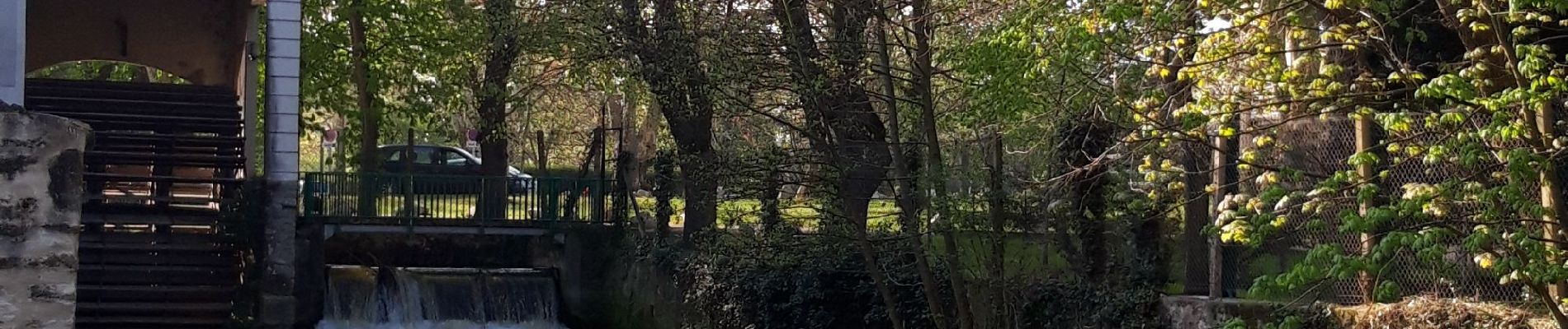
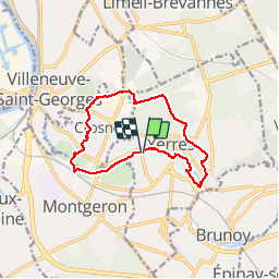
Trail Walking of 11.9 km to be discovered at Ile-de-France, Essonne, Yerres. This trail is proposed by jeanmarcMasson.
Photos


Positioning
Country:
France
Region :
Ile-de-France
Department/Province :
Essonne
Municipality :
Yerres
Location:
Unknown
Start:(Dec)
Start:(UTM)
461675 ; 5395900 (31U) N.
Comments