


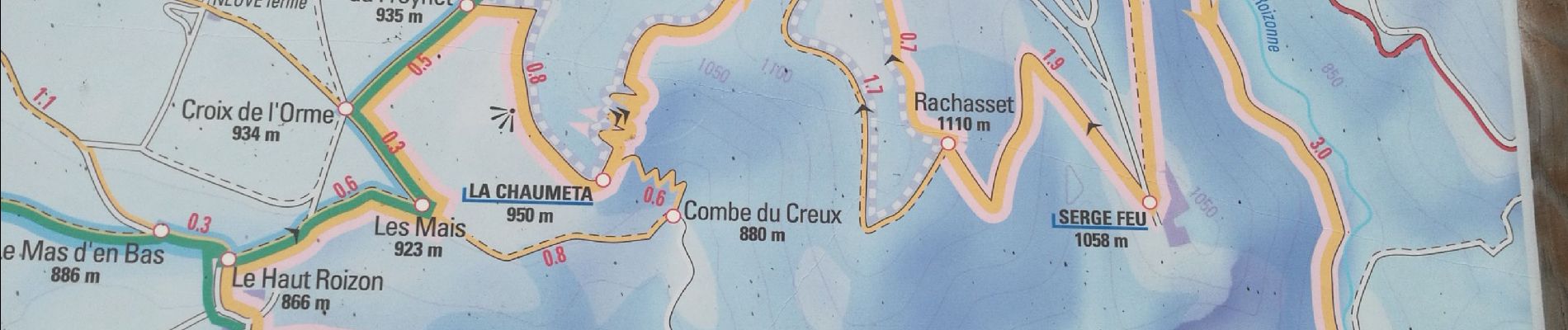
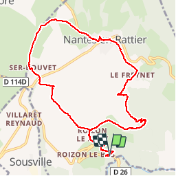
Pont de la Roizonne - Nantes en Rattier

maupassant38
User

Length
11.5 km

Max alt
993 m

Uphill gradient
349 m
Km-Effort
16.2 km

Min alt
750 m

Downhill gradient
351 m
Boucle
Yes
Creation date :
2019-04-17 08:17:59.921
Updated on :
2019-04-17 13:51:31.716
2h47
Difficulty : Medium

FREE GPS app for hiking
 SityTrail
IGN / Geographical institutes
SityTrail Plus
The world is yours!
About
Trail Walking of 11.5 km to be discovered at Auvergne-Rhône-Alpes, Isère, Nantes-en-Rattier. This trail is proposed by maupassant38.
Photos


Positioning
Country:
France
Region :
Auvergne-Rhône-Alpes
Department/Province :
Isère
Municipality :
Nantes-en-Rattier
Location:
Unknown
Start:(Dec)
Start:(UTM)
723186 ; 4977339 (31T) N.
Comments