


caserne et musée sapeurs-pompiers

PhilippeC54
User
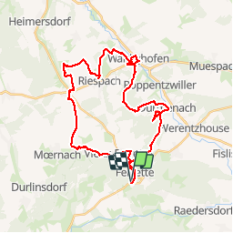

Length
36 km

Max alt
578 m

Uphill gradient
667 m
Km-Effort
45 km

Min alt
341 m

Downhill gradient
676 m
Boucle
Yes
Creation date :
2019-04-17 06:47:37.954
Updated on :
2019-04-17 14:10:56.752
5h05
Difficulty : Very easy

FREE GPS app for hiking
 SityTrail
IGN / Geographical institutes
SityTrail Plus
The world is yours!
About
Trail Mountain bike of 36 km to be discovered at Grand Est, Haut-Rhin, Ferrette. This trail is proposed by PhilippeC54.
Positioning
Country:
France
Region :
Grand Est
Department/Province :
Haut-Rhin
Municipality :
Ferrette
Location:
Unknown
Start:(Dec)
Start:(UTM)
372770 ; 5261018 (32T) N.
Comments