


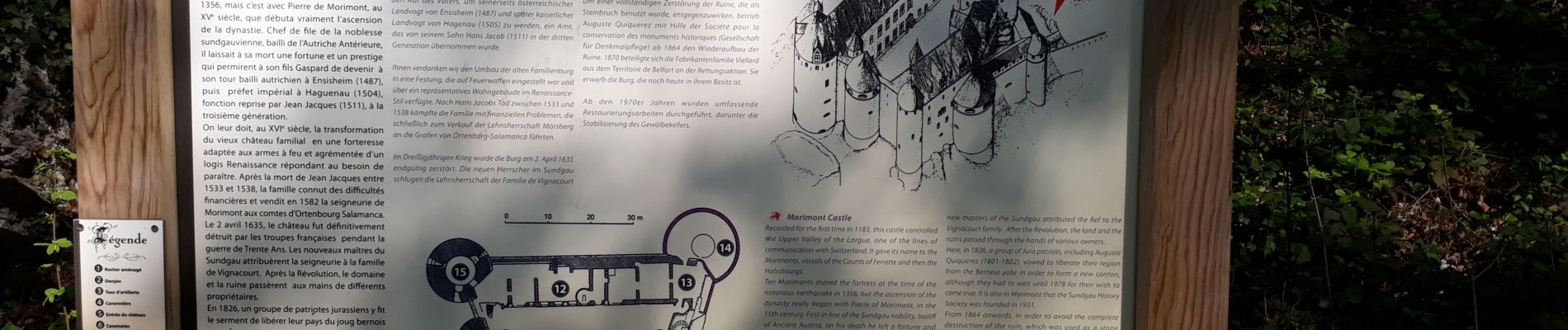
Château de Morimont

PhilippeC54
User

Length
31 km

Max alt
651 m

Uphill gradient
637 m
Km-Effort
39 km

Min alt
435 m

Downhill gradient
663 m
Boucle
Yes
Creation date :
2019-04-19 06:57:32.756
Updated on :
2019-04-21 09:26:09.292
3h34
Difficulty : Very easy

FREE GPS app for hiking
 SityTrail
IGN / Geographical institutes
SityTrail Plus
The world is yours!
About
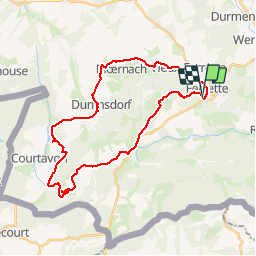
Trail Mountain bike of 31 km to be discovered at Grand Est, Haut-Rhin, Bendorf. This trail is proposed by PhilippeC54.
Photos


Positioning
Country:
France
Region :
Grand Est
Department/Province :
Haut-Rhin
Municipality :
Bendorf
Location:
Unknown
Start:(Dec)
Start:(UTM)
372747 ; 5261027 (32T) N.
Comments