


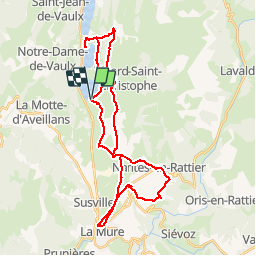
LAC DE PIERRE CHATEL - LA MURE - NANTES EN RATTIER

maupassant38
User

Length
40 km

Max alt
1145 m

Uphill gradient
759 m
Km-Effort
50 km

Min alt
867 m

Downhill gradient
762 m
Boucle
Yes
Creation date :
2019-04-22 16:04:42.599
Updated on :
2019-05-15 18:29:41.347
2h38
Difficulty : Medium

FREE GPS app for hiking
 SityTrail
IGN / Geographical institutes
SityTrail Plus
The world is yours!
About
Trail Mountain bike of 40 km to be discovered at Auvergne-Rhône-Alpes, Isère, Pierre-Châtel. This trail is proposed by maupassant38.
Positioning
Country:
France
Region :
Auvergne-Rhône-Alpes
Department/Province :
Isère
Municipality :
Pierre-Châtel
Location:
Unknown
Start:(Dec)
Start:(UTM)
719245 ; 4983180 (31T) N.
Comments