


Longuyon 25-04-19

patdecosnes
User
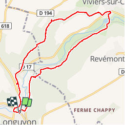

Length
9.2 km

Max alt
334 m

Uphill gradient
227 m
Km-Effort
12.2 km

Min alt
209 m

Downhill gradient
228 m
Boucle
Yes
Creation date :
2019-04-25 12:10:12.233
Updated on :
2019-04-25 17:50:02.082
2h32
Difficulty : Easy

FREE GPS app for hiking
 SityTrail
IGN / Geographical institutes
SityTrail Plus
The world is yours!
About
Trail Walking of 9.2 km to be discovered at Grand Est, Meurthe-et-Moselle, Longuyon. This trail is proposed by patdecosnes.
Description
sentier du Limaçon
club vosgien longuyon
Positioning
Country:
France
Region :
Grand Est
Department/Province :
Meurthe-et-Moselle
Municipality :
Longuyon
Location:
Unknown
Start:(Dec)
Start:(UTM)
688588 ; 5480526 (31U) N.
Comments