


les sources de l huveaune

Vero7684
User
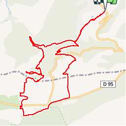

Length
14.6 km

Max alt
706 m

Uphill gradient
464 m
Km-Effort
21 km

Min alt
407 m

Downhill gradient
464 m
Boucle
Yes
Creation date :
2019-04-25 08:55:56.984
Updated on :
2019-04-25 18:18:23.171
5h25
Difficulty : Easy

FREE GPS app for hiking
 SityTrail
IGN / Geographical institutes
SityTrail Plus
The world is yours!
About
Trail Walking of 14.6 km to be discovered at Provence-Alpes-Côte d'Azur, Var, Nans-les-Pins. This trail is proposed by Vero7684.
Positioning
Country:
France
Region :
Provence-Alpes-Côte d'Azur
Department/Province :
Var
Municipality :
Nans-les-Pins
Location:
Unknown
Start:(Dec)
Start:(UTM)
725734 ; 4804556 (31T) N.
Comments