


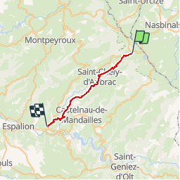
Etape 3 Aubrac- St Come D'olt- Couvent Malet

guariso
User

Length
24 km

Max alt
1321 m

Uphill gradient
326 m
Km-Effort
31 km

Min alt
388 m

Downhill gradient
1250 m
Boucle
No
Creation date :
2019-04-28 15:49:59.956
Updated on :
2019-04-28 15:52:25.981
6h06
Difficulty : Very difficult

FREE GPS app for hiking
 SityTrail
IGN / Geographical institutes
SityTrail Plus
The world is yours!
About
Trail Walking of 24 km to be discovered at Occitania, Aveyron, Saint-Chély-d'Aubrac. This trail is proposed by guariso.
Description
3 eme étape St Jacques
Positioning
Country:
France
Region :
Occitania
Department/Province :
Aveyron
Municipality :
Saint-Chély-d'Aubrac
Location:
Unknown
Start:(Dec)
Start:(UTM)
498919 ; 4940949 (31T) N.
Comments