


la sinne par le col des portes

Coryphene
User
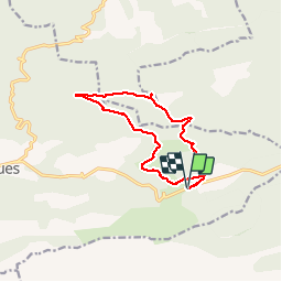

Length
12.4 km

Max alt
710 m

Uphill gradient
286 m
Km-Effort
16.2 km

Min alt
521 m

Downhill gradient
287 m
Boucle
Yes
Creation date :
2019-04-30 07:47:12.561
Updated on :
2019-05-02 13:22:29.987
3h44
Difficulty : Very easy

FREE GPS app for hiking
 SityTrail
IGN / Geographical institutes
SityTrail Plus
The world is yours!
About
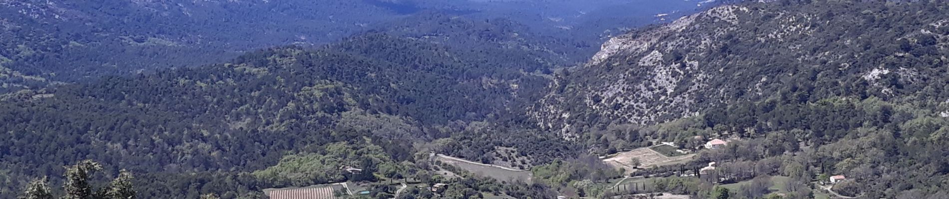
Trail Walking of 12.4 km to be discovered at Provence-Alpes-Côte d'Azur, Bouches-du-Rhône, Vauvenargues. This trail is proposed by Coryphene.
Photos


Positioning
Country:
France
Region :
Provence-Alpes-Côte d'Azur
Department/Province :
Bouches-du-Rhône
Municipality :
Vauvenargues
Location:
Unknown
Start:(Dec)
Start:(UTM)
715824 ; 4825413 (31T) N.
Comments