


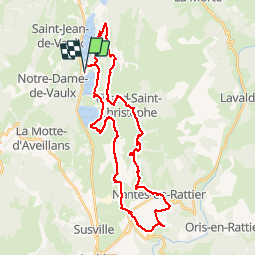
Belvédère Olivier Messiaen - Nantes en Rattier

maupassant38
User

Length
38 km

Max alt
1239 m

Uphill gradient
895 m
Km-Effort
50 km

Min alt
847 m

Downhill gradient
893 m
Boucle
Yes
Creation date :
2019-05-01 08:15:58.137
Updated on :
2019-05-01 12:19:01.873
3h46
Difficulty : Difficult

FREE GPS app for hiking
 SityTrail
IGN / Geographical institutes
SityTrail Plus
The world is yours!
About
Trail Mountain bike of 38 km to be discovered at Auvergne-Rhône-Alpes, Isère, Saint-Théoffrey. This trail is proposed by maupassant38.
Positioning
Country:
France
Region :
Auvergne-Rhône-Alpes
Department/Province :
Isère
Municipality :
Saint-Théoffrey
Location:
Unknown
Start:(Dec)
Start:(UTM)
718812 ; 4986258 (31T) N.
Comments