


Hambers Montaigu et retour

MichelRando7656
User
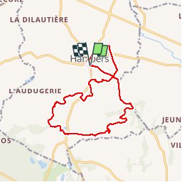

Length
15 km

Max alt
289 m

Uphill gradient
266 m
Km-Effort
18.6 km

Min alt
131 m

Downhill gradient
265 m
Boucle
Yes
Creation date :
2019-05-01 08:07:12.454
Updated on :
2019-05-01 14:20:38.969
6h11
Difficulty : Medium

FREE GPS app for hiking
 SityTrail
IGN / Geographical institutes
SityTrail Plus
The world is yours!
About
Trail Walking of 15 km to be discovered at Pays de la Loire, Mayenne, Hambers. This trail is proposed by MichelRando7656.
Description
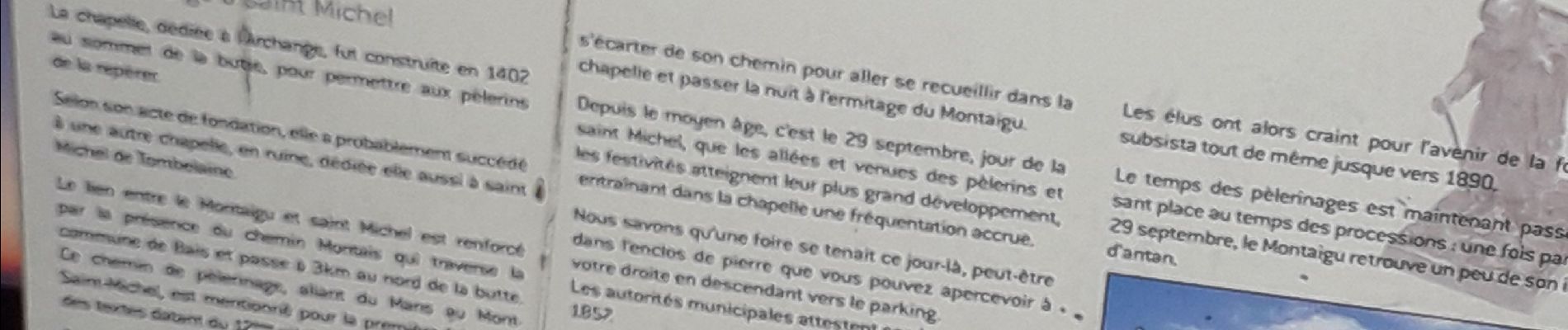
Superbes chemins de campagne qui mènent au village de caractère de Montaigu. Chapelle saint Michel au sommet.
Photos


Positioning
Country:
France
Region :
Pays de la Loire
Department/Province :
Mayenne
Municipality :
Hambers
Location:
Unknown
Start:(Dec)
Start:(UTM)
691698 ; 5347600 (30U) N.
Comments