


etape 4 couvent malet-Estaing

guariso
User

Length
21 km

Max alt
523 m

Uphill gradient
532 m
Km-Effort
28 km

Min alt
312 m

Downhill gradient
607 m
Boucle
No
Creation date :
2019-05-04 06:29:45.438
Updated on :
2019-05-04 06:30:28.83
6h00
Difficulty : Very difficult

FREE GPS app for hiking
 SityTrail
IGN / Geographical institutes
SityTrail Plus
The world is yours!
About
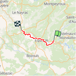
Trail Walking of 21 km to be discovered at Occitania, Aveyron, Saint-Côme-d'Olt. This trail is proposed by guariso.
Positioning
Country:
France
Region :
Occitania
Department/Province :
Aveyron
Municipality :
Saint-Côme-d'Olt
Location:
Unknown
Start:(Dec)
Start:(UTM)
485640 ; 4929772 (31T) N.
Comments