


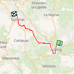
etape 5 Estaing- Golhinhac camping

guariso
User

Length
14.3 km

Max alt
666 m

Uphill gradient
588 m
Km-Effort
21 km

Min alt
312 m

Downhill gradient
243 m
Boucle
No
Creation date :
2019-05-04 06:42:03.908
Updated on :
2019-05-04 06:42:44.374
4h35
Difficulty : Very difficult

FREE GPS app for hiking
 SityTrail
IGN / Geographical institutes
SityTrail Plus
The world is yours!
About
Trail Walking of 14.3 km to be discovered at Occitania, Aveyron, Estaing. This trail is proposed by guariso.
Positioning
Country:
France
Region :
Occitania
Department/Province :
Aveyron
Municipality :
Estaing
Location:
Unknown
Start:(Dec)
Start:(UTM)
473927 ; 4933421 (31T) N.
Comments