


etape 6 Golinhac - Conques Abbaye

guariso
User
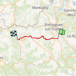

Length
21 km

Max alt
680 m

Uphill gradient
432 m
Km-Effort
28 km

Min alt
294 m

Downhill gradient
798 m
Boucle
No
Creation date :
2019-05-04 06:57:04.598
Updated on :
2019-05-04 06:57:46.938
5h43
Difficulty : Very difficult

FREE GPS app for hiking
 SityTrail
IGN / Geographical institutes
SityTrail Plus
The world is yours!
About
Trail Walking of 21 km to be discovered at Occitania, Aveyron, Golinhac. This trail is proposed by guariso.
Positioning
Country:
France
Region :
Occitania
Department/Province :
Aveyron
Municipality :
Golinhac
Location:
Unknown
Start:(Dec)
Start:(UTM)
466925 ; 4938966 (31T) N.
Comments