


01-Le Buet-Refuge la Pierre à Bérard

geranimo
User
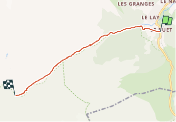

Length
5.2 km

Max alt
1927 m

Uphill gradient
576 m
Km-Effort
11 km

Min alt
1351 m

Downhill gradient
9 m
Boucle
No
Creation date :
2019-05-06 15:34:18.834
Updated on :
2021-09-27 18:49:45.849
2h20
Difficulty : Medium

FREE GPS app for hiking
 SityTrail
IGN / Geographical institutes
SityTrail Plus
The world is yours!
About
Trail Walking of 5.2 km to be discovered at Auvergne-Rhône-Alpes, Upper Savoy, Vallorcine. This trail is proposed by geranimo.
Positioning
Country:
France
Region :
Auvergne-Rhône-Alpes
Department/Province :
Upper Savoy
Municipality :
Vallorcine
Location:
Unknown
Start:(Dec)
Start:(UTM)
338979 ; 5098227 (32T) N.
Comments