


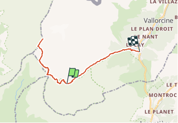
02-Refuge Pierre à Bérard-Mont Buet-le Buet

geranimo
User

Length
14.6 km

Max alt
3083 m

Uphill gradient
1182 m
Km-Effort
32 km

Min alt
1351 m

Downhill gradient
1762 m
Boucle
No
Creation date :
2019-05-06 15:42:16.32
Updated on :
2021-09-27 18:50:39.612
5h55
Difficulty : Difficult

FREE GPS app for hiking
 SityTrail
IGN / Geographical institutes
SityTrail Plus
The world is yours!
About
Trail Walking of 14.6 km to be discovered at Auvergne-Rhône-Alpes, Upper Savoy, Vallorcine. This trail is proposed by geranimo.
Positioning
Country:
France
Region :
Auvergne-Rhône-Alpes
Department/Province :
Upper Savoy
Municipality :
Vallorcine
Location:
Unknown
Start:(Dec)
Start:(UTM)
334985 ; 5096601 (32T) N.
Comments